20.05.-26.05.2019
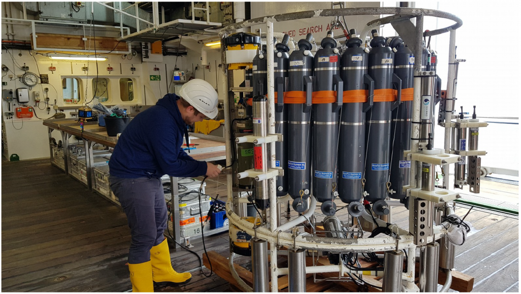
At the beginning of the second week of our cruise MSM83, we made several stops on the way to the Irish shelfbreak to check and test the proper functioning of our equipment. Firstly, we made sure that our main ship-based water sampling system, with attached CTDO unit and currentmeters meters, was fully functional. This so-called “rosette” is lowered by the ship’s winch towards the sea floor and then brought back on board. On the way down and up, the CTDO unit provides information on the vertical distribution of the conductivity of the seawater (C), from which the salinity in the seawater is determined, the temperature (T), the oxygen content (O), and information on each measuring depth of the rosette (D). At the end of such a CTDO station, we have an idea of what the water mass properties and current distributions look like in depth, with a vertical resolution of about 1m. On the way back from the sea floor we close, at selected depths, sampler bottles with a capacity of 10l. This will give us the necessary water samples to carry out our on-board analysis to ensure the quality of the CTDO data. On the other hand, we can determine the content of human-generated trace gases in seawater like chlorofluorocarbons (CFCs) and sulphur hexafluride (SF6). These gases are introduced into the deep sea in only a few places in the world ocean by exchange processes between the atmosphere and the sea surface. They are then redistributed in the deep ocean with the ocean currents. The Labrador Sea, located between Canada and Greenland, is a region where in late winter the surface water saturated with gases such as oxygen, CO2, CFCs, SF6 or argon cools down considerably. This cooling increases the water density and causes vertical convection, a prccess of vertical mixing and sinking that mixes the near-surface water properties down to a depth of 1500-2000m. As a result of this convection, Labrador Sea Water forms, which spreads across the entire North Atlantic at approximately 1000-2500m depth and whose propagation pathways we will cross several times on our cruise MSM83.
Early Thursday morning, 23.05.2019, we reached the 47°N section and thus also the position of the deep-sea mooring EB-2 installed by the Federal Maritime and Hydrographic Agency (BSH) at a depth of 4400m. We were able to recover this mooring successfully in calm sea state and sunshine. In the afternoon of the same day we also recoverd the mooring EB-1 of the University of Bremen, which was installed a little closer to the Irish shelf break at a depth of 1500m. These moorings serve to record the properties of the water masses and currents that flow along the European shelf towards the north and then enter the North Sea. The exploring of the data from the recovered instruments has been progressing since then, all moored devices have reliably measured over the last deployment period. The CTDO data we measured at Goban Spur on the Irish Shelf has first traces of Labrador Sea Water and Mediterranean Outflow Water flowing through the Strait of Gibraltar into the Atlantic Ocean.
On Sunday afternoon, 26.05.2019, we reached the position BP-32, where we installed an inverted bottom-mounted echo-sounder last year. Using acoustic methods, we were able to record the entire time series recorded by the device since April 2018, more in the next weekly report. Work on the Irish shelf break is now complete, and we are now progressing westward through the North Atlantic. Best wishes on behalf of all cruise participants aboard „Maria S. Merian“,
Dagmar Kieke (Chief Scientist)
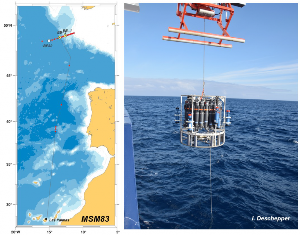
Right: The rosette is on its way to the ocean bottom.
(Map: D. Kieke, photo: I. Deschepper)